Visiting Keppel Island (or Prive) in Singapore? The following are directions and a map on how to get there.
It starts with a step-by-step pictorial guide to Keppel Island by public transport, followed by a map and driving directions to the island.
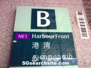
Take a train to Harbourfront MRT Station. Exit the station by Exit B.

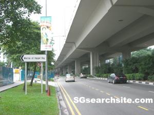
You shall see HarbourFront Centre upon exiting the MRT station.

Walk towards the Opposite HarbourFront Int Bus Stop (14121) found along the main road (Telok Blangah road). And take any of the above buses.
The bus will cruise along Telok Blangah Road. Get ready to alight at the next bus stop.

Alight at the Caribbean at Keppel Bay bus stop (14131).

Walk towards the direction where you came from (just a couple of steps away) and you shall see the entrance to Keppel Island.
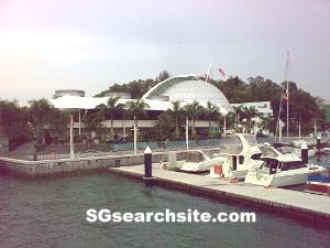
After 10-15 mins walk, you shall reach Keppel Island and see the above landmark – Marina at Keppel Bay (where Prive is located).
Map and Driving Directions (Click on Route for Directions)
View Keppel Island – Map and Driving Directions in a map.
For more information on Prive.